- برنامهها
- تناسب اندام
ViewRanger
مشاهدهی نتایج بررسی آنتیویروس
تصاویر برنامه

معرفی برنامه
جزئیات بیشتر
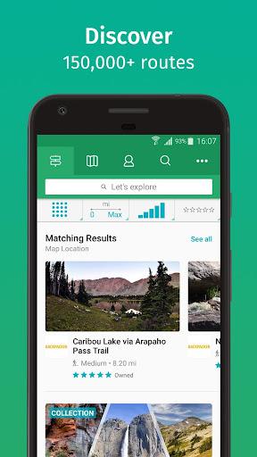
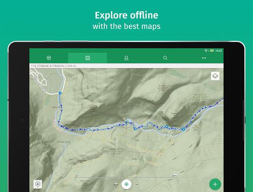
ViewRanger GPS گوشی شما را به یک ابزار مسیریابی کامل در مکانهای دوردست تبدیل میکند.
با نقشههای کامل از سطح دنیا.
نقشهای کامل برای علاقهمندان به سفرهای خارج شهری.
نظرات کاربران - ۱۴۶ رأی
۴.۲ از ۵
۵
۴
۳
۲
۱

مهدی939
برنامه فوق فوق افتضاهی هست. فقط به درد اونایی میخوره که گوشی شون gps نداره...
داود
برنامه ای بسیار عالی برای کوه و طبیعت گردی فقط نیاز به یادگیری و آموزش دارد بسیار مناسب برای رفتن به مکانهای بکر با دانلود مپ از قبل
htc sensation xe بده.
gps خوده كوشي بهتره اين برنامه بدرد اونايي ميخوره كه اينترنت بالايي دارن.
برنامههای مرتبط
Thenx: Calisthenics Training
تناسب اندام
Running Distance Tracker +
تناسب اندام
Pedometer - Step Counter, Weight & Calorie Tracker
تناسب اندام
چای و دمنوش ها
تناسب اندام
MyFitnessPal: Calorie Counter
تناسب اندام
Biorhythm Calculator
تناسب اندام
Start Running. Zero to 5K
تناسب اندام
Suunto
تناسب اندام
Sports Tracker: Run Bike Hike
تناسب اندام
Garmin Connect™
تناسب اندام
دیگران نصب کردهاند
برنامههای مشابه
GPS Essentials
سفر
Live Earth Map - World Map 3D
رفت و آمد
Gaia GPS: Offline Trail Maps
رفت و آمد
Navigation for Google Maps Go – راهنمای مسیریابی
سفر
نقشهی همراه یزد
سفر
Gps Area Calculator
رفت و آمد
نقشه آفلاین راههای ایران
سفر
MAPS.ME – Offline maps, guides and navigation
سفر
Floor Plan Creator
ابزارها
MapFactor GPS Navigation Maps
رفت و آمد